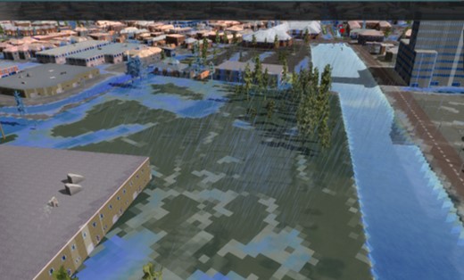
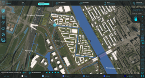
The Urban Water Design OpTioneering (UWDOT) tool is part of RESCIDO, the Toolbox in which we have collected our designers’ multiple solutions to complex urban water problems. The combined implementation of these solutions can make cities more resilient and thus more sustainable.
Why Urban Water Design Optioneering?
The increasingly multi-functional urban land use and a changing climate mean that planning issues are becoming more and more complex. This is also partly due to the increased variety of stakeholder categories. In this context, decision-making is more successful if all the parties involved jointly analyse the planning process scenarios. This means sitting down together at the table to divide responsibilities, but also to share insights and jointly identify solutions. This working method requires an integrated approach in which the available knowledge is brought together in a digital model. Water in the city typically plays a central role here.

There is therefore a growing need for a tool that makes knowledge meaningful in a practical context, combines disciplinary knowledge, and provides an evaluation framework to identify the most attractive solution. Today’s solutions must increasingly connect with the world of tomorrow. In the contemporary complex built environment, process-supporting software is needed in order to visualise the outcomes of different scenarios. A functional model of the reality, combined with serious gaming, offers you the possibility of successfully realising this process and thus fully satisfying your needs. Dareius offers to work with you with UWDOT so that we together can look into the (virtual) future.
What UWDOT Offers
- A digital model of your project area within minutes
- Open-source data that are directly available (DEM, road network, buildings, etc.)
- Effective optimisation based on your own data
- Support during interactive multi-stakeholder sessions
- A test of the impact of interactive measures on different scenarios
- Insightful cost-benefit analysis for each scenario

Setting to work with UWDOT
We build an initial digital model of your project area with the available open data. We then jointly develop the most relevant precipitation scenarios, taking account of the changing climate, and your plans and possible concerns. The impacts on vulnerable areas are rendered visible and jointly assessed on the basis of area knowledge. The result offers insight into the impacts in risk areas. If desired, we can apply our Urban Water Planning to determine well-founded measures, which we can subsequently discuss with stakeholders. This makes decisions comprehensible, financially substantiated by a transparent cost-benefit analysis and therefore more broadly supported.
Download the content of this page